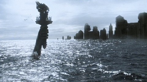
New York City on Hurricane Irene path / Breaking News

Lying on Hurricane Irene path, New York is planning to shut down transportation system, evacuate areas before the hurricane arrives.
New York Mayor Michael Bloomberg talked to local officials and residents concerning the preparation for Hurricane Irene inside St. Luke’s Baptist Church in Laureltoni as the city of New York lies on Hurricane Irene path.
The question is are New York residents worried that Hurricane Irene will have a major impact on its path New York City?
New York on Hurricane Irene path
Lying on Hurricane Irene path, New York is planning to shut down the entire transportation system on Saturday in anticipation of Hurricane Irene’s arrival. A mandatory evacuation of all nursing homes in flood-prone areas of New York was also ordered. The monster hurricaneIrene is expected hit New York as a Category 1 hurricane sometime Sunday, barreling in with winds of more than 90 miles-per-hour and torrential rains.
New York Mayor Bloomberg informed Thursday that it was “very conceivable” that he will order a mandatory evacuation of all low-lying areas of New York, which is on Hurricane Irene path, by Saturday. “Hurricane Irene is predicted to be very dangerous,” the mayor warned residents of New York lying on Hurricane Irene path. New York city municipal recommended New York citizens start going to less vulnerable areas,” Bloomberg added at the end of th news conference .
Irene Hurricane path to New York from space
Astronaut Ron Garan tweeted this picture of Hurricane Irene from the International Space Station (NASA), showing Hurricane Irene path to New York. Watches for Hurricane Irene were posted for New York and much of the Northeast on Friday morning as Hurricane Irene path jogged northward, putting the whole of the East Coast on hurricane alert.
The hurricane Irene warning that was put into effect in North Carolina on Thursday was extended by the National Hurricane Center to Virginia, Maryland, Delaware and New Jersey on Friday morning, indicating that preparations for the storm should be completed as soon as possible.
Hurricane Irene path to New York at 110 miles pro hour
The hurricane center informed Friday morning that maximum winds at the center of the Hurricane Irene approaching on a path to New York were 110 miles per hour, making it a Category 2 storm, down slightly from the 115-m.p.h. winds that were reported a day earlier. But it could gain strength as it approaches the coast and eventually New York, which lies on Hurricane Irene’s path.
A decision will be made by Saturday morning on whether to call for a mandatory evacuation of all low-lying areas in what referred to as “Zone A,” which includes Coney Island, the Rockaways and Battery Park City. About 250,000 New Yorkers live in Zone A, which also includes South Beach and Midland Beach in Staten Island. Five hospitals in Zone A are also required to evacuate, including Coney Island Hospital. “Tonight, Coney Island Hospital will begin placing patients in vacant beds in other hospitals in other parts of the city,” Major Bloomberg stated.
New York on the verge of disaster : It lies on Hurricane Irene path
“We are also notifying the other hospitals in the other Zone A areas in New York on Hurricane Irene path as well as nursing homes and senior centers that they must – I repeat, must – evacuate beginning tomorrow and complete the process by 9 p.m. tomorrow night.”
Weather experts are exceedingly concerned about Hurricane Irene because it is set to lash parts of the United States that are less accustomed to hurricanes, like the Jersey Shore and Long Island. The Hurricane Irene is expected to make landfall in North Carolina on Saturday, then scrape up the coast toward New York, lying on Hurricane Irene path on Sunday.
[adrotate banner=”34″]


You guys are creeps. We live in NJ and my husband’s grandmother in Oregon is TERRIFIED right now because of BS pictures like this. The first picture on google if you search for hurricane information is the statue of liberty under water! You’re d.g.